

Du följer nu
Fel vid följande av användare.
Den här användaren tillåter inte att andra användare följer dem.
Du följer redan den här användaren.
Din medlemskapsplan låter dig endast följa 0 användare. Uppgradera här.
Du har avföljt
Fel vid sluta följa användare.
Du har nu rekommenderat
Fel vid rekommendation vid användare.
Något gick fel. Var god uppdatera sidan och försök igen.
Email verifierad.

guelmim,
morocco
Datum, tid och plats: 2:28 fm
Gick med maj 16, 2017
1
Rekommendation
Ayoub L.
@ayoubGis
4,2
4,2
100%
100%
guelmim,
morocco
100 %
Slutförda jobb
100 %
Inom budget
100 %
Inom tid
20 %
Återanställningsgrad
GIS, RS & Territorial Development
Kontakta Ayoub L. om ditt uppdrag
Logga in för att diskutera detaljer i chatten.
Portfolio
Portfolio

Spatial analysis

Spatial analysis
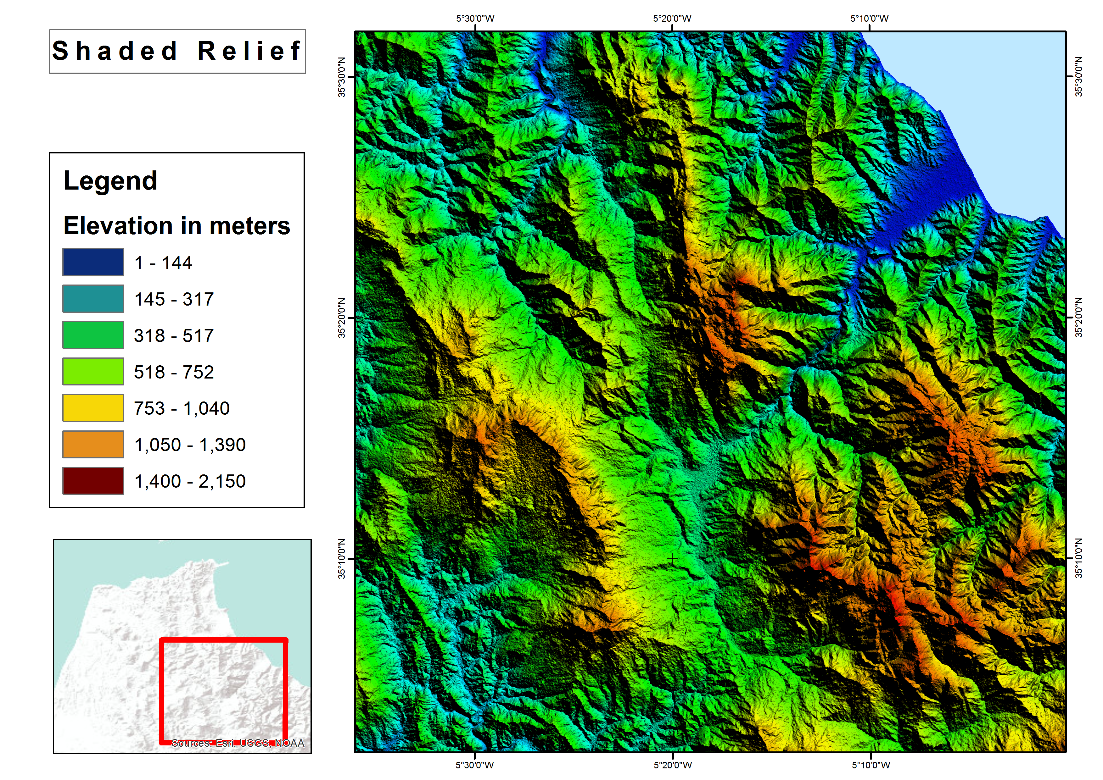

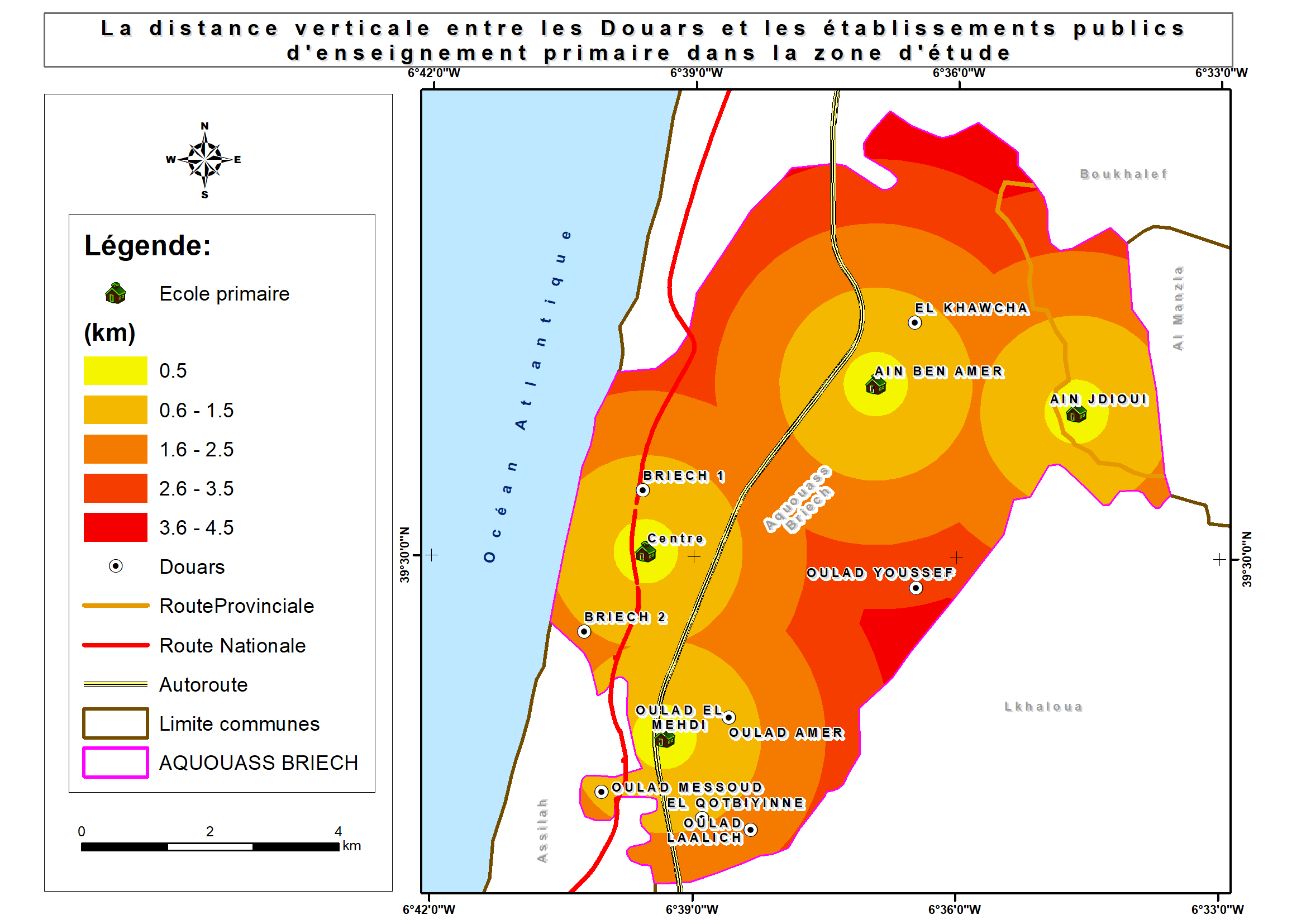
Shaded relief map
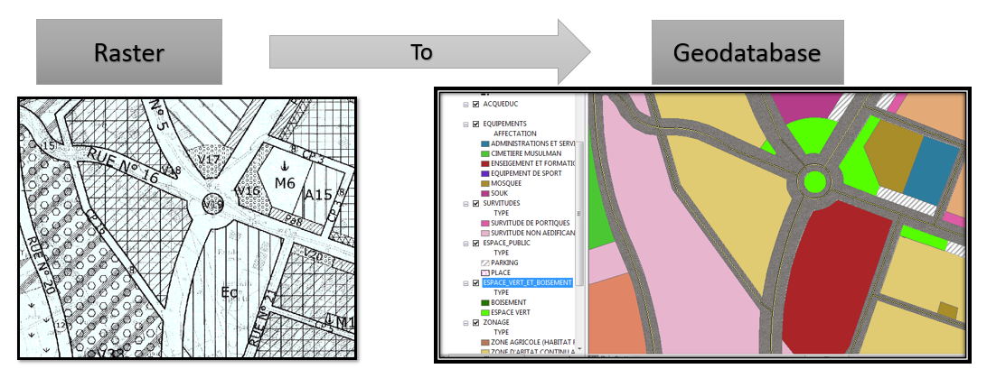

Raster to Geodatabase
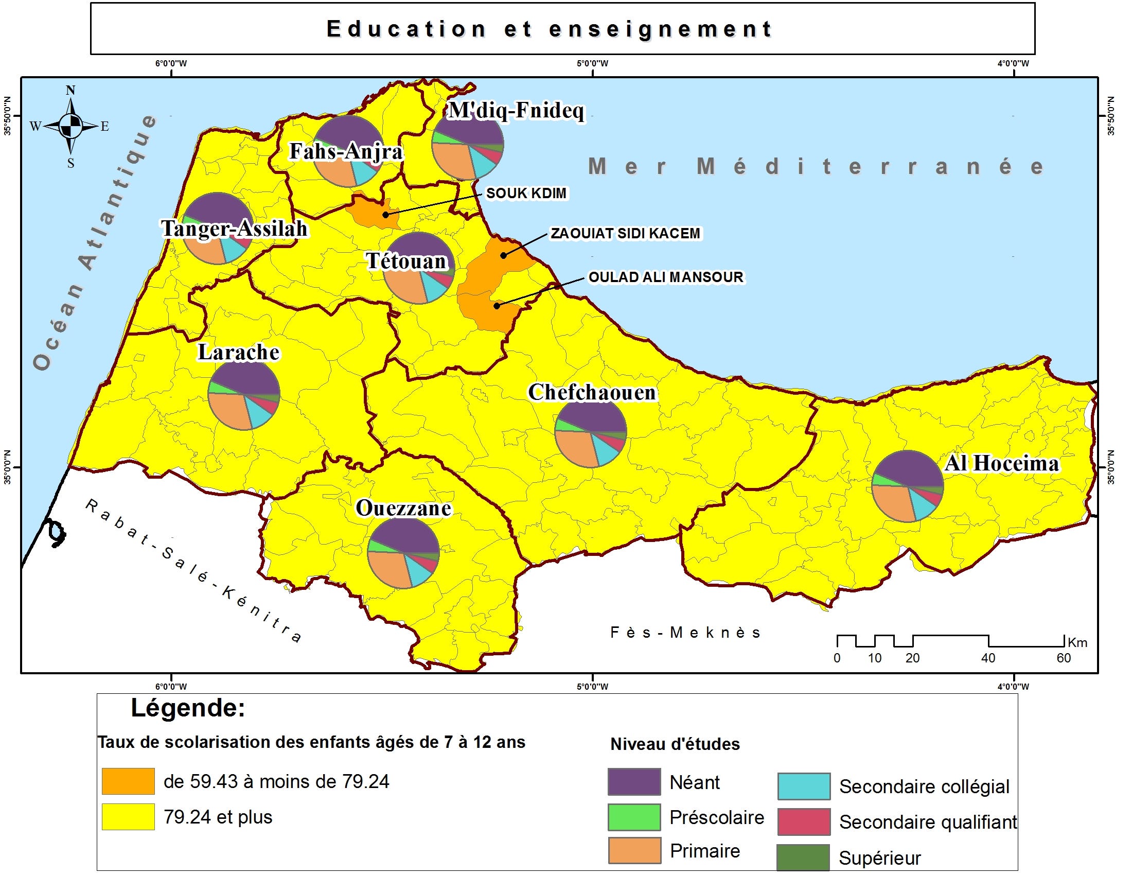

Thematic maps

Thematic maps

Thematic maps

Thematic maps

Brochure with Business Card

Brochure with Business Card
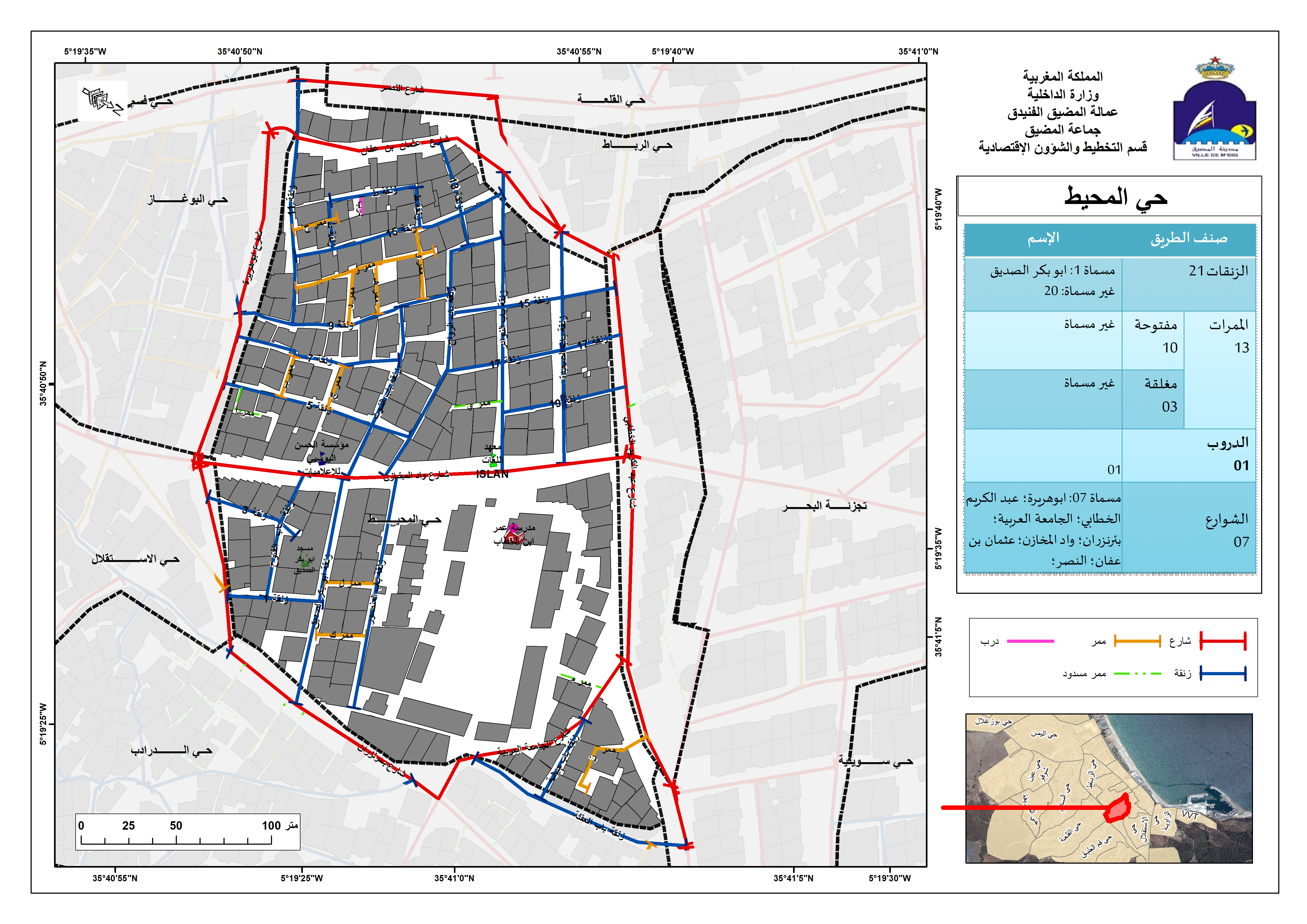

Street Addressing and Naming System
Spatial analysis
Spatial analysis
Shaded relief map
Raster to Geodatabase
Thematic maps
Thematic maps
Thematic maps
Thematic maps
Brochure with Business Card
Brochure with Business Card
Street Addressing and Naming System
Recensioner
Ändringar sparade
Visar 1 - 5 av 9 omdömen
$150,00 USD
Data Processing
Data Mining
Geospatial
JSON

•
€40,00 EUR
N

•
$10,00 USD
PHP
Data Processing
Data Entry
Excel
Web Scraping
A
•
€90,00 EUR
N
•
$50,00 USD
Logo Design
Illustrator
Prezi
Geospatial
+1 till

•
Erfarenhet
GIS Specialist
jan. 2018 - Nuvarande
• Performed geospatial analyses;
• shared interactive maps and services in ArcGIS Online;
• Collected and processed Landsat images for M’diq city;
• Used GIS technique (Desktop/Mobile) and Microsoft Access in business activities survey;
• Mapped a land use plan for M'diq-Fnideq prefecture beach;
• Designed billboards for Beach;
• Created Gis-based Street Addressing and Naming System;
• Mapped a Traffic Signs plan for M’diq city;
• Created compelling visual presentations.
Cartographer/GIS
jan. 2017 - juni 2017 (5 månader, 1 dag)
Designed land use plan using Geographical Information System.
GIS Intern
aug. 2016 - sep. 2016 (1 månad, 1 dag)
Created Geodatabase for Guelmim-Oued Noun Regional Roads.
Utbildning
Master's degree, Territorial Development and Spatial Governance
(3 år)
Bachelor's degree, Geography
(3 år)
Kontakta Ayoub L. om ditt uppdrag
Logga in för att diskutera detaljer i chatten.
Verifikationer
Toppkompetenser
Bläddra bland liknande frilansare
Bläddra bland liknande utställningar
Inbjudan skickades med framgång!
Tack! Vi har skickat en länk för aktivering av gratis kredit.
Något gick fel med ditt e-postmeddelande. Vänligen försök igen.
Kopia till urklipp misslyckades, försök igen efter att ha justerat dina behörigheter.
Kopierat till urklipp.
Laddar förhandsgranskning
Tillstånd beviljat för geolokalisering.
Din inloggningssession har löpt ut och du har blivit utloggad. Logga in igen.